

Dernière mise à jour : 27 mai 2024 à 12h52 → pas de commentaire
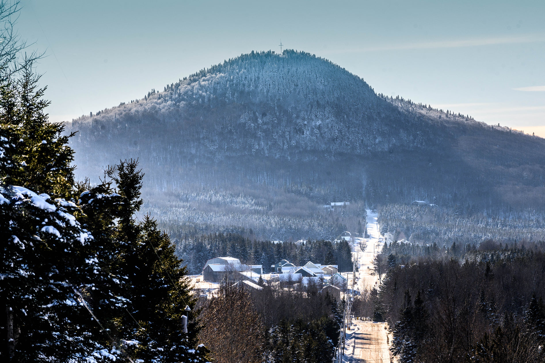
Les sentiers des Etchemins is a tourism project that habiter en région salutes, because this initiative, put forward by visionary people from the Etchemins region, is one of Saint-Magloire’s strongest tourist attractions.
For more details on the Mont Bonnet trail, visit the balises Québec fact sheet.
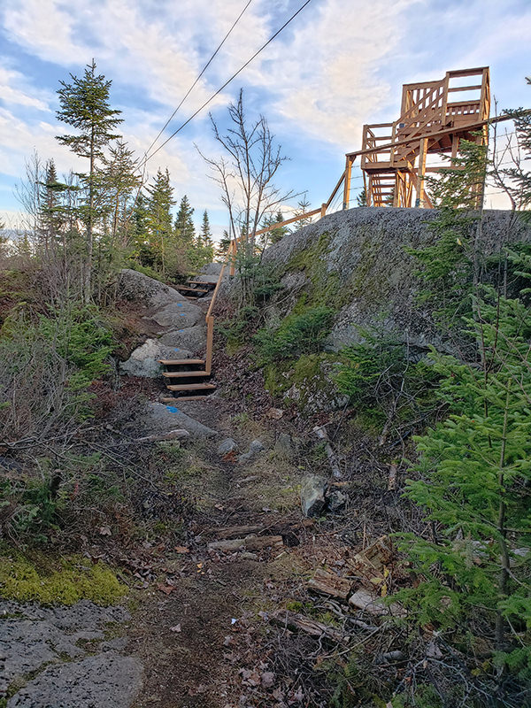
Here are a number of images of the Mont Bonnet trail.
Over the past few months, the municipality of Saint-Magloire has acquired a plot of land adjacent to the main entrance to the trail leading hikers to the summit of Mont Bonnet, in rang St-Cyrille. One parcel of land has been resold, and the other will be used for a parking lot, as well as for toilets, shelters and wilderness camping.
« People will no longer need to park along the site owner’s (Stéphane Veilleux) road, which will be less dangerous for everyone. Since we’re expecting an increase in visitor numbers over the next few years, we know that we’re going to become an important gateway to the trails, especially on 281, » recalls Mayor Daniel Thibault. Source: Sentiers des Etchemins: a big year ahead in 2024
Here are ourlodging solutions for hikers who want access to comfortable, affordable accommodations with breathtaking views.
This hiking trail in the Saint-Magloire, Saint-Luc-de-Bellechasse and Sainte-Sabine sectors will soon join the Massif du Sud hiking trails.
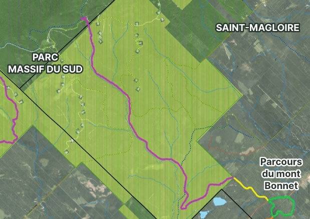
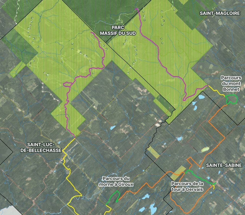
HIKING TRAILS

OPEN

OPEN IN 2024

PROJECTED
(Les Sentiers des Etchemins)

PROJECTED
(in collaboration with Parc du Massif du Sud)
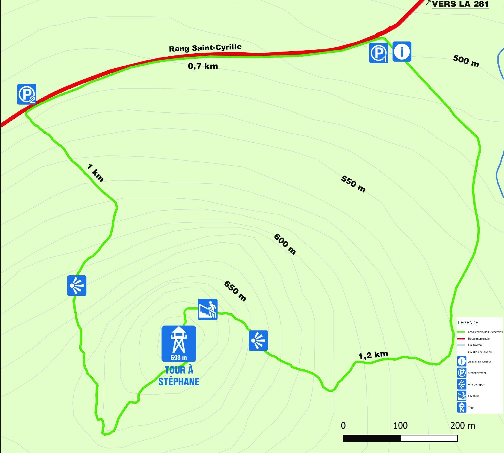
2.9 km loop
Elevation gain approx. 200 m
SEE THE ROUTE
Loop or retrace your steps on the same side.
2.9 km loop or return on the same side.
The Tour à Stéphane, at the very top of the mountain, offers a 360-degree view of the surrounding seven Etchemins villages.
Approx. 200 m
693 meters
Maple stand, mixed forest
3
P1 segment at the tower: From parking lot P1, follow the trail south. Gentle, steady slope for the first third, then steeper. Stairs near the top.
Segment P2 to tower: From parking lot P2, take trail south. Fairly steep slope.
Between the two ends, walk 700 m down the row to complete the loop.
OVERALL MAP
From Route 281 in Saint-Magloire, head west on Rang Saint-Cyrille for about 5 km.
Parking:
You can park on the edge of the rang near the trailhead in parking lots P1 or P2, where indicated by signs. Be careful not to block traffic.
Round trip
3.2 km (total)
Height difference approx
130 m
Linear round trip
4.8 km (total)
Height difference approx
170 m
Hautes-Terres route (Summer 2023)
Loop of
9 km loop
Elevation gain approx
170 meters

© Copyright 2023-2026 habiterenregion.com - All rights reserved Legal Notices - Graphic design, web development, web integration and web strategy by Vanille Idylle